
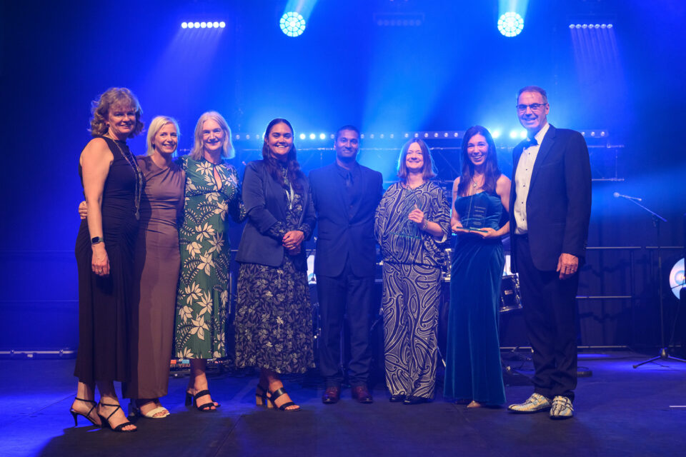

Image: The Nancy Northcroft Planning Practice Award winning team: Jaimee Cannon (second from left) and Jane Rennie (Boffa Miskell), Felicity Foy, Azman Reuben and Tammy Wooster (Far North District Council), Senior Associate – Planning Megan Couture (Beca), with New Zealand Planning Institute chair Andrea Harris (far left) and Chief Executive David Curtis (far right).
Innovative engagement strategies used to develop a Far North spatial plan made trade-offs relatable, humanised the plan, expanded understanding, and strengthened public dialogue, writes Kathleen Kinney, Boffa Miskell’s business services communications and media advisor.
Far North District Council [FNDC] brought together mana whenua, technical experts, rangatahi [young people], stakeholders and the wider community to shape Te Pātukurea Kerikeri-Waipapa Spatial Plan.
The result is an award-winning 30-year spatial plan, and a case study in how innovative communication and strong project teamwork turned complex planning choices into a shared vision for the future.
When FNDC began work on the Spatial Plan, the challenge was bigger than simply deciding where growth should go. It was to create a community-led plan for two of the district’s fastest growing settlements, while navigating competing interests and significant time pressure – all while a district plan review process was underway.
Unsustainable growth
Kerikeri-Waipapa is the district’s largest population centre and a key economic, cultural and service hub. Kerikeri anchors retail, tourism, culture and services, while Waipapa has developed as an industrial and employment hub for the wider region.
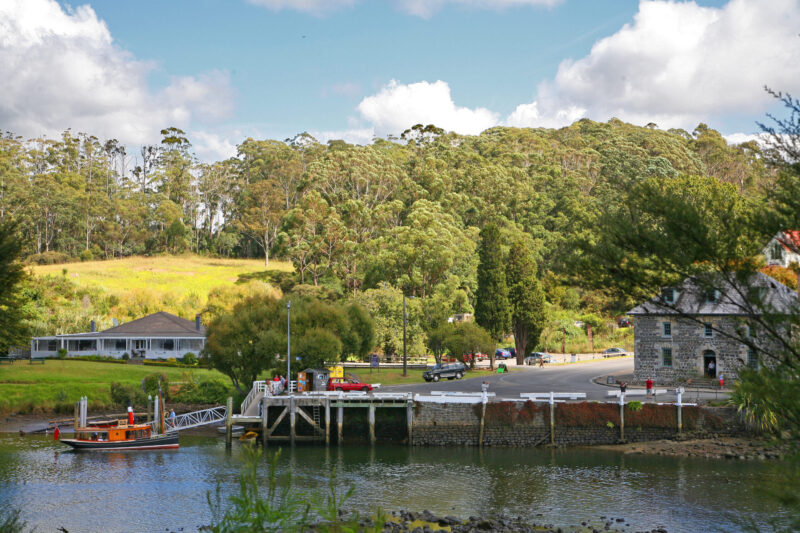
However, growth has become increasingly unsustainable: over the past decade, 51 percent of residential building consents in the study area were issued in rural zones. The spread of rural lifestyle housing has reduced housing choice and affordability, increased reliance on large, detached homes, and made infrastructure more expensive and complex to deliver.
First initiated in 2021, the Spatial Plan had no statutory mandate or legislative deadline; but growth projections indicated a clear way forward for the Far North’s key economic and cultural hubs was needed to support the Council’s decision-making.
Over the next two years, resource management reforms, the introduction and repeal of the Spatial Planning Act, the early stages of Local Water Done Well and the Cyclone Gabrielle recovery were competing for attention and resources.
In mid-2023, Far North District Council established a dedicated Growth Planning and Placemaking team, giving the project the resourcing it needed.
Creating something special
Growth Planning and Placemaking Team Leader, Jaye Michalick, says although the time pressure remained, momentum lifted considerably.
“The pressure was somewhat based in the community’s expectation that the Plan should be further along, given when it was initially commenced. We needed to progress at pace; and we were committed to keeping stakeholders and the public involved in the process.”
Along with Far North District Council staff, the core project team included planners from engineering consultancy Beca and environmental consultancy Boffa Miskell.
“The common goal of creating something special for the Far North’s first spatial plan really brought the team together,” says Jaye.
“We had expert team members who had supported others on great spatial planning projects around the motu. Given the time constraints, a critical role was the project coordinator who kept us all on task and allowed each of the subject matter experts to focus on the outputs.”
Holistic approach
Boffa Miskell planner Jaimee Cannon, who was the project coordinator, says a defining feature of Te Pātukurea was that it was planning-led, rather than project-led.
“A planning-led spatial plan takes a holistic, systems-thinking approach, ensuring long-term place outcomes drive investment and development decisions, rather than individual projects or sector priorities.”
In practice, that meant growth, infrastructure, environmental protection and community aspirations were considered together through an integrated, evidence-based strategy.
The 18-month timeframe was extremely truncated, as the Spatial Plan needed to be adopted in time to inform hearings, recommendations and decisions on the Proposed District Plan.
Personas aid understanding
Early engagement began at the end of 2023 and the draft plan was delivered and adopted in June 2025, so presenting information in a way that was easily understood by different members of the community was essential.
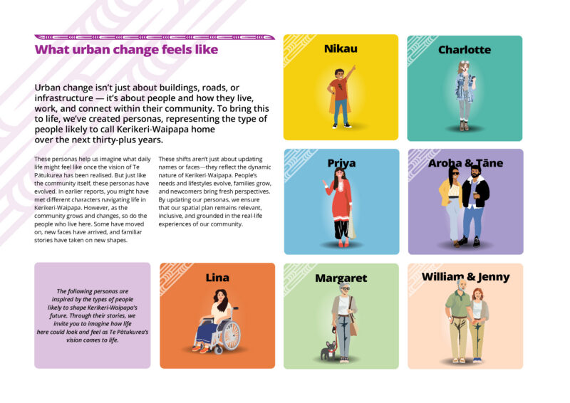
Innovative engagement strategies – including the creation of fictional but data-informed personas representing the diversity of local life, from rangatahi to kaumātua [respected elders] to new families – made complex trade-offs relatable, humanised the plan, expanded understanding, and strengthened public dialogue.
The engagement personas originated with Consultant Planning Lead Megan Couture, a Senior Planning Associate at Beca.
“In software development and testing, personas are used to understand how different people might engage with a product or service,” she explains.
“A big challenge with spatial planning is that change happens over time. The personas helped us explain that journey to the community and show how Te Pātukurea might impact different demographics.”
From late 2023 and throughout 2024, FNDC engaged with the Hapū Rōpū Governance Group, local partners, stakeholders and the wider community. In late 2024, the Council sought public feedback on a Growth Scenarios Report that presented six possible growth scenarios.
Hybrid solution
The preferred option was ultimately a hybrid of two scenarios.
The Kerikeri South Focused Expansion scenario ranked highest overall through expert analysis and infrastructure cost efficiency. It supported compact, infrastructure-efficient growth near existing networks and improved transport connectivity and access to social infrastructure.
The Waipapa Focused Expansion scenario was the community’s preferred option, with strong support for the town’s growth as a business and employment hub, although it required infrastructure upgrades.
The hybrid combined the strengths of both: efficient growth, stronger centres, and alignment with cultural and environmental priorities. Each scenario was tested against factors such as infrastructure costs, resilience to natural hazards, transport efficiency, housing affordability and cultural and environmental considerations.
The Plan directs 95 percent of future development into existing urban areas, reducing pressure on rural land and supporting more compact, connected and resilient communities.
It also supports growth within and immediately adjacent to the existing built-up areas of Kerikeri and Waipapa, establishes walkable catchments, and provides for 20 to 40 percent of residential growth through intensification, including duplexes, terraces and walk-up apartments where appropriate.
For Kerikeri, the Plan concentrates change in and around the existing urban area while protecting the town’s heritage, character and role as a Bay of Islands destination.
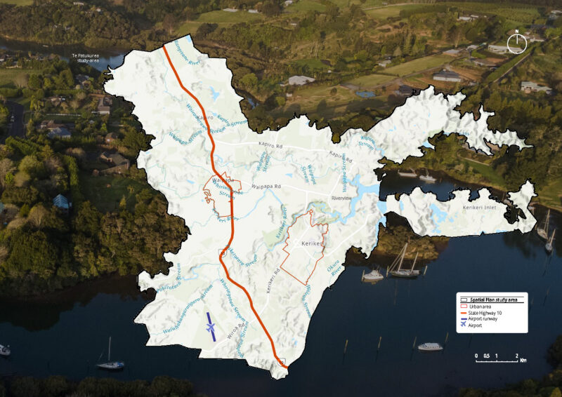
In Waipapa, it supports growth as a complementary commercial and employment hub, including large-format retail, while retaining smaller-format retail in Kerikeri to support its traditional town centre role.
Across both settlements, the Plan identifies new transport connections, green spaces, recreational and community facilities, blue-green network enhancements and additional land for industrial uses and infrastructure.
Cultural and youth input
A strong partnership with the Hapū Rōpū Governance Group shaped one of the Plan’s most distinctive tools: the mapping of Wāhi Toitū and Wāhi Toiora.
Wāhi Toitū identified “no-go” areas where development should be avoided, while Wāhi Toiora identified areas where growth should proceed carefully.
These areas were informed by constraints mapping and hapū input, helping direct development away from culturally and environmentally sensitive locations.
Rangatahi engagement was another point of difference. Rather than simply asking young people standard consultation questions, the project enabled them to design their own engagement process.
FNDC partnered with Healthy Families Far North, which had an existing process supporting rangatahi to engage with other young people on civic projects. They developed the questions they wanted to ask, led much of the in-person engagement, and later presented submissions directly to elected members.
Jaye says this was a high point in the process.
“There’s so much value in seeking out input from the youth. I would encourage other councils to build rangatahi-focused engagement sessions into each engagement or consultation stage of a project.
“Diversity of voices in a spatial plan adds richness and avoids an outcome that reflects only the regular or loudest voices of a community.”
Collaboration recognised
The New Zealand Planning Institute gave The Spatial Plan the 2026 Nancy Northcroft Planning Practice Award – the Institute’s Supreme Award.
It recognised the Plan’s collaborative and place-based approach to long-term planning in Northland.
The judges say Te Pātukurea is more than a spatial plan. “It is a demonstration of what planning can achieve when rangatahi are empowered, mana whenua lead in genuine partnership, and communities are supported to meaningfully engage with complex decisions.”
The Plan is now moving into implementation. FNDC has begun work on critical actions, including establishing a Community Reference Group, progressing a structure plan for Waipapa and starting to develop an urban design framework and guidelines for Kerikeri.
As implementation takes place, keeping the community involved and working with hapū will remain a priority. The now-familiar group of personas are expected to ‘age’ in real-time and continue to illustrate how life could look and feel as the vision of the Plan comes to fruition.
Te Pātukurea is a spatial plan that is both ambitious and practical. It gives Kerikeri-Waipapa a clear direction for compact growth, housing choice, infrastructure investment, environmental protection and centre development.
Just as importantly, it shows how a small council outside of a main centre can produce a sophisticated spatial plan at pace when there is commitment across the organisation: support from elected members, backing from management, cross-council collaboration, and a dedicated project team working with hapū and key stakeholders.
The Spatial Plan was delivered, not because legislation demanded it, but because Far North District Council recognised the need for a collective vision for the communities’ future.