
Councils are under increasing pressure to plan for ‘climate change mitigation’, but that is easier said than done in an isolated island nation with a complicated and variable maritime climate, and where coastal land is rising out of the sea in many places. Alan Titchall explains.
Our country has occupied its isolated position between two vast oceans with complicated weather patterns for the past 45 million years and still remains one of the most geologically ‘mobile’ continents (Zealandia) on the planet.
This is largely because the active Pacific–Australian plates cut right through our continent, with the 600 kilometre Southern Alps mountain the result of the ongoing oblique thrusting of Pacific Plate crust over the Australian Plate along the Alpine Fault.
The sideways movement at the Alpine Fault and resulting compression pushes up the Southern Alps at rates of up to 11mm per year, and has been doing this for the past five million years.
Which means over the past 12 million years the Southern Alps might have been uplifted by 20 kilometres if it wasn’t for erosion through harsh weather maintaining their height below 4000 metres, as a rainfall of 10 metres a year, slopes of 35 degrees, and fast flowing rivers spread the erosion material across the lowland plains or dumps on to the sea floor.
Otherwise our alps would be higher than the Himalayas and Mt Cook way higher than Everest.
Suffice to say, our nation has changed enormously in a geologically short span of time and continues to do so as the plates below us move and the tectonic forces adjust and heave upward, lifting coastal areas out of the sea on our eastern side.
The most recent such case is only four years old, when much of the north eastern coast of the South Island was uplifted during the 14 November 2016, M7.8 earthquake by a metre, and that earthquake was mostly horizontal not vertical. GPS applications estimate the coast was raised between half a metre to two metres, from about 20 kilometres south of Kaikoura all the way north to Cape Campbell.
Before this, during the past 150 years alone, a whopping M8.2 quake in 1855 raised much of the Wellington region by up to two metres. In 1931 a M7.8 earthquake also raised land around Napier by up to two metres above sea level. Land that used to be an estuary now harbours the Napier/Hawke’s Bay airport.
Evidence preserved in landscapes demonstrate that many parts of the country’s coast have been repeatedly uplifted through time; including raised marine beaches and terraces along the Kaikoura Peninsula, Wairarapa coast, Cape Kidnappers, Mahia Peninsula, north of Gisborne and East Cape.
This uplift is through tectonic seismology, and while our climatology authorities claim to predict future sea levels, they can’t predict earthquakes.
Waiting for big tremble
The horizontal movement of the Alpine Fault is about 30 metres per 1000 years, which is bloody fast by global geological standards.
This happens through ‘ruptures’ that also move vertically, lifting the Southern Alps in the process and shaking the bejesus out of the South Island. In between these earthquake inducing ruptures, the Alpine Fault is locked.
It is accurately estimated that the fault has ruptured four times in the past 900 years and each time this has produced an earthquake of about M8.
GNS Science research of the Alpine fault earthquake over the past 8000 years found the mean interval between large earthquakes on the fault is 330 years, and two thirds of the intervals were between 260 and 400 years. Among the spread of intervals, the longest was about 510 years and the shortest 140 years.
Based on how regularly it has ruptured in the past, it is predicted that the Alpine Fault has a high probability of rupturing in the next 50 years, or long before the worst predicted sea rise scenario.
The bad news is such a rupture will produce one of the largest and most devasting M8 earthquake since European settlement of New Zealand.
The Darfield (Canterbury) earthquake September 2010 had a magnitude of M7.1 and a magnitude 8 earthquake releases about 30 times more energy than M7.
So, a M8 earthquake will result in violent shaking, widespread landslides and weaken rock that will make landslides more common for years. Rivers could change course and will certainly carry more sediment and therefore flood more easily. Town and infrastructure such as roads, bridges, power lines and communication services will be disrupted, and West Coast industries seriously disrupted.
And the aftershock sequence could involve earthquakes of as much as M7 that continue for many years.
Some land coming up, some going down
Meanwhile, as the Pacific Plate collides with the Australian Plate at a rate of about 40mm a year the resulting compression continues to lift parts of the East coast of the North Island faster than predicted sea level rises that were estimated between 1961 and 2018 at 2.44mm a year (data from Land Information New Zealand and New Zealand Hydrographic Authority).
If you can rely on the country’s four port tidal gauges (which weren’t designed for this purpose) an analysis in 2004 of long term records from these gauges indicated an average rate of increase in sea level of 1.6 mm a year for the 100 years (to the year 2000), which is considered to be relatively consistent with other regional and global sea level rise calculations when corrected for glacial-isostatic effects
The East Coast of the North Island is also rotating clockwise while the South Island is sliding obliquely towards the Alpine Fault, pushing the Southern Alps up 10mm a year (as previously said, the weather wears them down at a similar rate).
The Hauraki Plains, Hamilton, Bay of Plenty, Marlborough Sounds, and Christchurch are said to be sinking, along with the North Island’s lower east coast, south of Napier and down through the Wairarapa region (which is dropping at a rate of around 5mm a year as tectonic shifts of the two plates along a fault line known as the Hikurangi subduction zone, pulls the Wairarapa coast down.
However, geologists and civil defence planners predict a major earthquake on the Hikurangi fault, that could reverse this trend.
The Kaikoura coastline was also subsiding before the 2016 quake lifted it back up.
In contrast, Wellington is coming out of the sea and rising as the Cook Strait shifts further south.
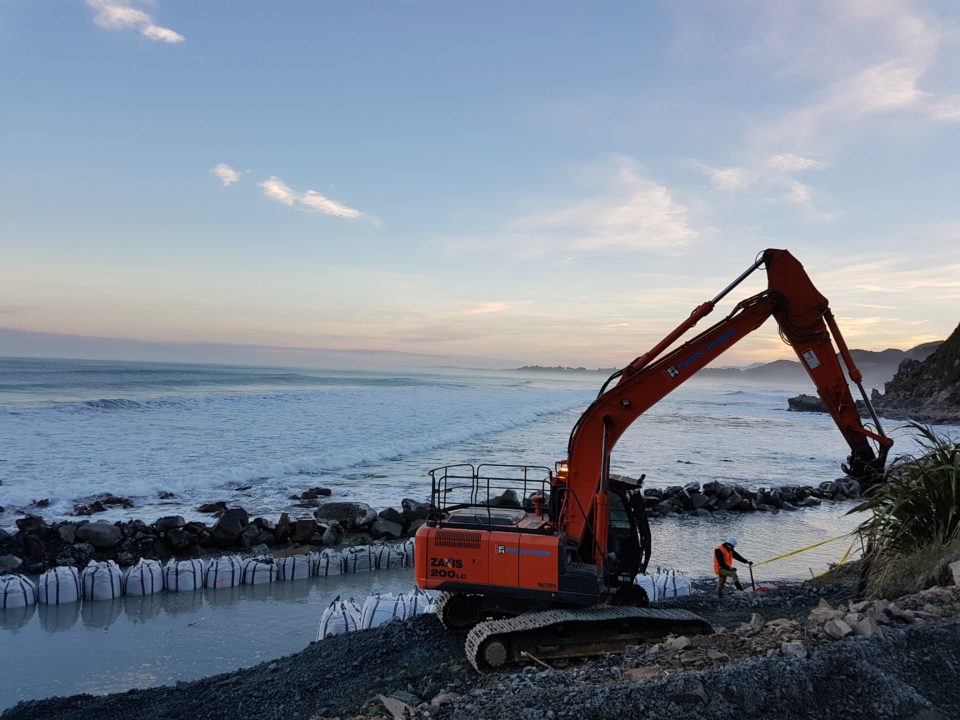
Coastal erosion
Another influence on local sea levels is natural coastal erosion, with variations between our western and eastern coastlines based on geology and exposure to waves. On the west coast ocean swells from the Tasman Sea and Southern Ocean are very energetic and drive sand back and forth, reshaping coastlines and sea levels.
In contrast, the east coast’s sand systems are more developed and features gentler wave action, although northern parts are disturbed occasionally by tropical cyclones.
However, as a geologically young country with soft sedimentary geology and surrounded by tempestuous seas, our coasts are naturally subject to change: both accretion where the shoreline builds out and erosion where shoreline retreats, either temporarily or permanently. On top of all this our fast flowing rivers change parts of our coastline through sediment deposits.
Sea levels are complicated
All of the above makes prediction for coastal communities over the next century and any advice for local authorities on what is expected to happen on their landscapes very difficult.
It doesn’t help that sea level rise predictions vary widely, depending who is beating the ‘emissions’ programme/tax drum and which carbon (dioxide) scenario model is used.
The Paris Agreement, which New Zealand signed up to, leads to a possible 81cm rise by 2100.
An Australian policy paper published by Breakthrough in May 2019 predicts a three degree rise in temperature leading to a sea level rise as high as three metres.
Closer to home, the Joint Antarctic Research Institute, at Victoria University of Wellington says; “New research suggests that sea level could rise as quickly as four metres per 100 years (or one metre per 25 years).”
Better coastal research on its way
New, sophisticated research on sinking and rising coasts, and associated sea levels, is being carried out right now, and already indicate variations across small distances with sea level rises and falls.
This research is being carried out by GNS Science’s Ian Hamling, who is working on a preliminary map of our coastlines using historical Synthetic Aperture Radar Interferometry (InSAR) data to generate a continuous vertical land movement estimate.
This work has mostly been achieved through the Sea Level Rise programme (https://www.searise.nz), and is also supported from a Marsden Fast Start Award Ian was granted in 2016. The programme will officially run for five years from 2018 to 2023, but could continue beyond that.
Researchers in the Sea Rise programme, which is a collaboration between GNS, NIWA and Victoria University of Wellington, will gauge the InSAR measurements against global sea level projections.
The final results are still in preparation, but already show remarkable variation across small distances, to the point residents in the same district are experiencing quite different sea level rises and falls, says Ian.
This variation stems from the complex tectonic and volcanic setting New Zealand finds itself in which leads to both spatial and temporal variations, says Ian.
He adds that the most noticeable coastal uplift seen so far was being experienced in the Bay of Plenty coast near Matata where, from 2003-2010, the land was rising by up to 10mm a year, and that lift has since dropped to about 3-4mm a year.