Large councils around the country are starting to appreciate that even if a flood zone hasn’t flooded for decades, it is still not wise to consent to building on them, because what goes around comes around and we live in a flood-risk country. By Alan Titchall.
This has been demonstrated in the northwest Auckland township of Kumeu, home to one of the world’s most famous wineries.
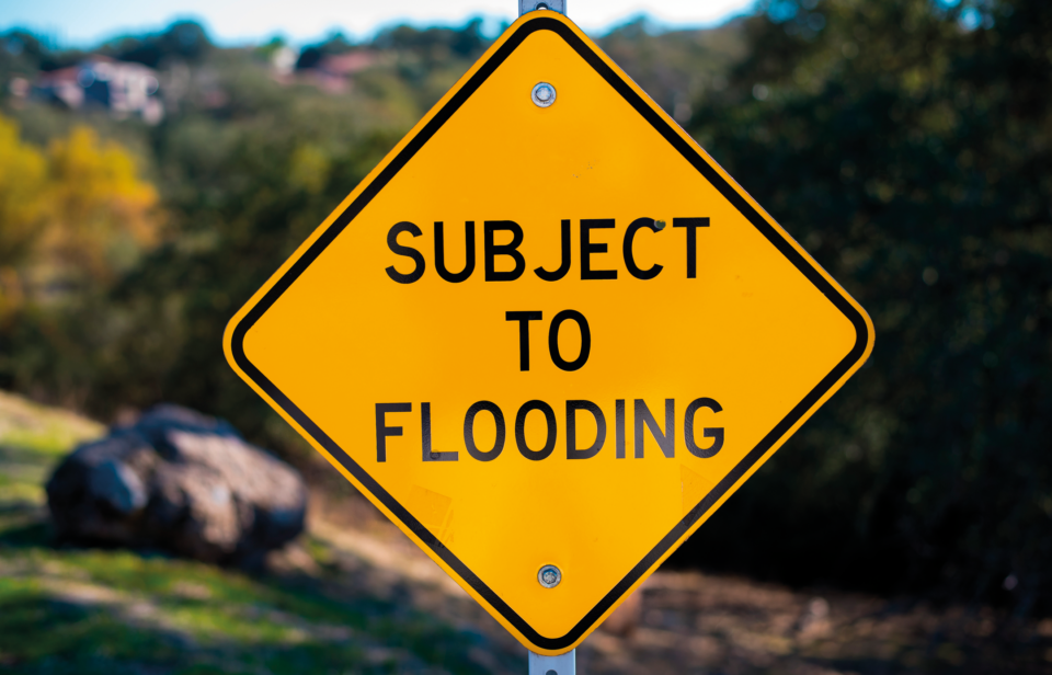
The Kumeu and Huapai area has a repeated history of flooding and, in recent years, has been hit twice with “massive amounts” of floodwater following overnight deluges that have produced up to 200mm of rain. The first was in 2021, when emergency services dealt with 370 calls for assistance after homes and commercial buildings were flooded and people had to be rescued from their cars. It then happened again in early 2023 when the entire Auckland district was hit with both a sub-tropical storm followed by a cyclone, causing widespread damage, mostly from flooding and landslides.
Many properties in Kumeu/Huapai, Parakai and Helensville sit on an extensive floodplain featuring the Kumeu River and its contributory streams, watercourses, natural waterways and overland flow paths. A lot of this natural watercourse is on, or is next to, private property. After the Auckland Super City merged all the city’s regional councils, a lot of the maintenance of these natural features has fallen on property owners, which the Auckland Council relies on for keeping waterways on private property clear of debris and blockages.
Greg Sayers, the Councillor for the Rodney District, admits that he received a lot of negative feedback from locals who believed the Kumeu River had only contributed to the flooding because it wasn’t kept clear of debris as the previous Rodney District Council [before the merger] used to.
After the first serious flooding in 2021 the community put pressure on the Auckland Council to start keeping the Kumeu River and drains in the area clear of debris and blockages.
Instead, Auckland Council’s Healthy Waters completed a flooding review of the area that looked at the causes of the flooding and the potential to reduce flood risk. This report said the first event was the largest rainfall recorded at this location and is statistically expected to occur less than once in a hundred years. It also said the flooding damage was generally in line with its modelling predictions and flood mapping for an event of this size. It also said its partly completed Kumeu River floodway had reduced the severity of the flooding, but due to the magnitude of the August 2021 storm, considerable flooding was still going to occur. Following this review, Auckland Council aimed to produce a final assessment by the end of 2023. This became redundant after the Auckland region was whacked by a sub-tropical storm deluge on January 31, 2023 that the Council and metrological services did not see coming.
This time, following intense flooding in the Kumeu and Huapai area, the Council engaged contractors to clear debris out of the Kumeu River from other wet areas, including large logs, willow trees and other vegetation.
This time, noting its flood maps were 100 percent accurate in determining how the area was going to flood, the Council admitted affected properties would flood again in the future as it “cannot stop the flooding. Landowners with the risk of flooding must remain prepared for such an event happening again.”
This message was cold comfort for those already permitted to build and live in the region, many of who were still getting over the flooding from two years ago, with insurance companies now refusing to insure some buildings while banks were reluctant to lend money on many affected houses.
Facing lower land values and more flooding in the future (especially if the climate change speculation proves right) property owners on the flood plain were told the Council could not afford the sort of flood mitigation (such as drilling a tunnel, building a dam and widening the river) that could help them. In February this year the Council offered a proposal to a group of about 200 locals who attended a special meeting to ‘shift the Kumeu town centre’ (a few hundred properties) over a number of years. Ward councillor Greg Sayer told them none of the flood migration solutions available to the Council could drop the flood level by over a required metre.
The best the Council could do in the short term, these residents were told, was put in an early warning system so people have “about four hours warning” and “stronger rules to prevent consenting houses to be built in the flood zone” starting by stopping new businesses from being built or opening in the current town centre.
In the long term, the Council proposes moving the entire town centre of Kumeu from that low-lying flood area, which involves moving around 200 properties to higher ground on the other side of the railway station, a bit further north.
“This won’t be an overnight fix – to move a whole town centre is going to take decades,” admitted Sayers.